
PROJECT
FalconResQ
| Asshray Sudhakar | AUTHOR | ACTIVE |
| Sohan Aiyappa | COORDINATOR | ACTIVE |
FalconResQ:Drone-Assisted LoRa Emergency Search & Rescue Communication System
Author: Asshray Sudhakara
Department: Electronics and Communication Engineering
Batch: MARVEL EvRe Batch 5 | AIR Coordinator
Executive Summary
FalconResQ is an infrastructure-independent emergency search and rescue communication system designed to operate reliably when conventional cellular and ground-based networks fail. The system integrates low-power LoRa beacons, drone-mounted aerial receivers, and an intelligent ground station interface to enable rapid victim localization across disaster zones, remote terrains, and infrastructure-compromised environments.
Core Innovation: By elevating the LoRa receiver on a drone, FalconResQ overcomes line-of-sight and Fresnel zone obstructions that plague ground-based communication, transforming a limited-range link into a wide-area detection network capable of covering up to 48.7 km distance and 1867.3 km² area from a single 50m altitude flight (Theoretically obtained by Link Budgeting - Plane Earth Model).
Problem Statement & Motivation
The Critical Gap in Disaster Communication
During disasters—earthquakes, floods, landslides, and infrastructure collapse—communication systems fail precisely when they're needed most:
- 95% of cell towers went offline during Hurricane Maria (2017)
- Thousands unreachable for days during the 2015 Nepal earthquake and 2018 Kerala floods
- Network congestion prevents even functioning infrastructure from serving emergency needs
- Rural and remote areas lack baseline coverage even in normal conditions
Traditional emergency systems (P25, TETRA, LTE-based FirstNet) depend on power, backhaul, and infrastructure that disasters routinely destroy. HAM radios require trained operators and fixed infrastructure. Flying cell towers (Verizon/Spooky Action) are expensive and require smartphone access victims may not have.
FalconResQ addresses this by providing:
- Zero infrastructure dependency
- One-button SOS operation (no training needed)
- Ultra-low power consumption (19.5 days continuous operation)
- Wide-area aerial coverage (up to 1867 km² per drone) {Theoretically obtained by Link Budgeting - Plane Earth Model}
- Fraction of the cost of conventional solutions
System Architecture
FalconResQ employs a three-tier wireless architecture designed around the capabilities of Heltec ESP32-S3 + SX1262 LoRa hardware platforms.
Architecture Overview

Communication Flow
The system operates in two modes based on beacon density:
Low-Traffic Mode (Few active beacons):
- Single uplink channel: 866.1 MHz (beacon → drone)
- Single relay channel: 866.9 MHz (drone → ground station)
- Direct forwarding with minimal latency
High-Traffic Mode (Many simultaneous beacons):
- Multi-channel operation: 4 uplink frequencies (866.1, 866.3, 866.5, 866.7 MHz)
- Slotted p-persistent CSMA: Random slot + channel selection
- Channel Activity Detection (CAD): RSSI-based sensing before transmission
- Drone channel scanning: 200ms dwell time across all channels
- Packet aggregation: Multiple beacons relayed in single downlink frame
View detailed operational sequence:

This adaptive strategy reduces collision probability from ~60% to <5% in high-density scenarios through frequency diversity, time diversity, and probabilistic channel access.
Hardware Components
1. Beacon Module (Heltec Wireless Tracker)

Core Specifications:
- MCU: ESP32-S3FN8 (dual-core Xtensa LX7, 240 MHz, 8MB flash)
- LoRa Radio: SX1262 transceiver (470-928 MHz, +22 dBm max TX, -148 dBm sensitivity)
- GNSS: UC6580 dual-frequency (L1+L5), multi-constellation (GPS/GLONASS/Galileo/BeiDou/NAVIC)
- Display: 0.96" RGB TFT (160×80 px)
- Battery: 3.7V Li-ion/LiPo with integrated charging
- Dimensions: 65.5 × 28.1 × 13.5 mm
Power Performance:
| Operating Mode | Current Draw |
|---|---|
| TX @ 17 dBm | 163 mA |
| GNSS Active | 89 mA |
| Deep Sleep | 15 µA |
Battery Life Calculation:
Duty cycle: 2.36% active (transmission every 5s, 118ms ToA)
Average current: (0.0236 × 90mA) + (0.9764 × 0.02mA) ≈ 2.14 mA

Battery life (1000 mAh): 1000 / 2.14 ≈ 467 hours ≈ 19.5 days
GNSS Performance:
- Cold start TTFF: <56.33s (observed) vs <26s (spec)
- Warm start TTFF: <8.88s (observed) vs <2s (spec)
- Horizontal accuracy (RMS): 9.12m (observed) vs 1.5m (spec)
Beacon Module Working Demo: Watch Video
2. Drone Platform
Two drone configurations are supported:
.png?raw=true)
Configuration A: Standard Multirotor
- LoRa receiver only payload
- Maximum endurance configuration
- Pure communication gateway role
Configuration B: FPV-Enabled Drone
| Component | Model | Qty | Weight (g) | Cost (₹) |
|---|---|---|---|---|
| Motor | T-MOTOR Velox V2306 V3 | 4 | 134.8 | 8,100 |
| Propeller | T-MOTOR P49436-3 | 4 | 14 | 2,754 |
| Flight Controller | T-MOTOR Velox F7 SE | 1 | 10 | 6,599 |
| ESC | T-MOTOR Velox 50A | 1 | 19 | 6,199 |
| Frame | TBS Source One V5 | 1 | 125 | 3,600 |
| Battery | Pro-Range 22.2V 16000mAh 6S LiPo | 1 | 1900 | 15,500 |
| FPV System | DJI O4 Air Unit Pro | 1 | 40 | 28,000 |
| FPV Goggles | DJI Goggles N3 | 1 | - | 37,000 |
| GPS Module | NEO-M8N | 1 | 15 | 1,424 |
| LoRa Receiver | Heltec WiFi LoRa 32 V3 | 1 | 50 | - |
| Action Cam | GoPro HERO 12 | 1 | 154 | 30,000 |
| TOTAL | ~2482g | ₹1,39,176 |
Performance:
- Thrust-to-weight ratio: 2.3:1 @ 100% throttle
- Expected flight time: 14-18 minutes
- Operational altitude: 50-100m (typical SAR missions)
3. Ground Station Receiver
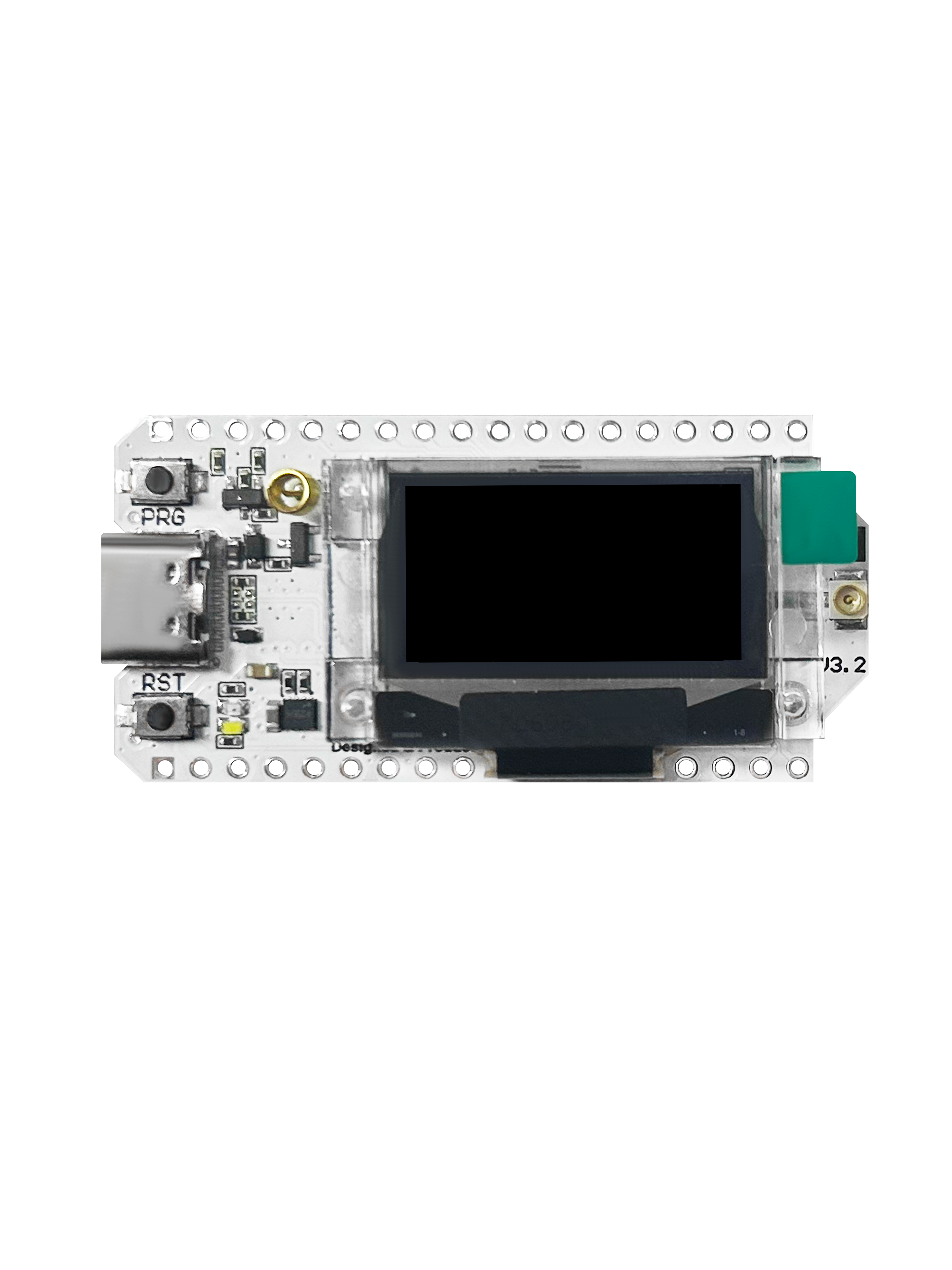
Hardware: Heltec WiFi LoRa 32 V3 (identical to drone receiver)
Key Differences from Beacon:
| Feature | Wireless Tracker (Beacon) | WiFi LoRa 32 V3 (Receiver) |
|---|---|---|
| GNSS | UC6580 built-in | Not present |
| Display | 0.96" RGB TFT (80×160) | 0.96" OLED (128×64) |
| Dimensions | 65.5 × 28.1 × 13.5 mm | 50.2 × 25.5 × 10.2 mm |
| Primary Role | Tracking transmitter | Communication receiver |
| Available GPIOs | Reduced (GNSS uses pins) | More free pins |
Technical Foundations
LoRa Technology Deep Dive
Chirp Spread Spectrum (CSS) Modulation:
- Information encoded in frequency-swept "chirps" spanning full bandwidth
- Enables demodulation at negative SNR (down to -20 dB @ SF12)
- Superior to FSK in noise and interference environments
Spreading Factor Trade-offs:
| SF | Symbol Duration | Data Rate | Sensitivity | Use Case |
|---|---|---|---|---|
| SF7 | Shortest | Highest | -124 dBm | Short range, good link |
| SF9 | Medium | Medium | -130 dBm | Balanced |
| SF12 | Longest | Lowest | -135 dBm | Maximum range |
FalconResQ Configuration:
- SF7 @ 125 kHz bandwidth (optimized for throughput and range)
- Coding rate: 4/5
- TX power: 17 dBm
- Frequency: 865-867 MHz ISM band (India)
Time on Air (ToA) Calculation:
Symbol duration: 2^7 / 125,000 = 1.024 ms
Preamble duration: 12.25 symbols × 1.024 ms = 12.54 ms
Payload duration: 103 symbols × 1.024 ms = 105.5 ms
Total ToA: ~118 ms per packet

Duty cycle @ 5s interval: 118ms / 5000ms = 2.36%
Link Budget Analysis
Comprehensive calculations documented in: Link Budget Spreadsheet
Key Results:
| Distance | Plane-Earth RSSI | Link Status |
|---|---|---|
| 0.5 km | -56.97 dBm | Strong |
| 1 km | -69.02 dBm | Good |
| 5 km | -96.97 dBm | Marginal |
| 10 km | -109.02 dBm | Near limit |
| 24.38 km | -124.5 dBm | Minimum decodable (SF7) |
Maximum Theoretical Coverage (Drone @ 50m altitude):

Using right-triangle geometry with hypotenuse = 24.38 km (link budget limit-Plane Earth Model):
Base (horizontal coverage radius) = √(24.38² - 0.05²) ≈ 24.38 km
Total coverage diameter = 2 × 24.38 km ≈ 48.76 km
Coverage area = π × (24.38)² ≈ 1867.3 km²
Without drone: Ground-to-ground max range ~24.38 km
Critical Insight: The drone enables 26× range improvement and 2200× area coverage increase compared to ground receivers.
Fresnel Zone Clearance
 Radio waves don't travel as a thin line—they occupy an elliptical "Fresnel zone" around the direct path. Obstructions within this zone cause diffraction loss and signal degradation.
Engineering Guideline: Maintain ≥60% Fresnel zone clearance
Drone Advantage: Elevating the receiver to 50-100m altitude clears terrain, buildings, and vegetation, restoring near-ideal line-of-sight conditions. This is why the drone is not optional—it's the fundamental enabler of long-range performance.
Ground Station Software Architecture
Technology Stack
| Component | Technology | Version | Role |
|---|---|---|---|
| Language | Python | 3.11 | Backend & application logic |
| Web Framework | Streamlit | ≥1.28 | Real-time dashboard UI |
| Mapping | Folium | ≥0.14 | Interactive victim location maps |
| Serial Comms | PySerial | ≥3.5 | Hardware interface |
| Analytics | NumPy, Pandas | Latest | Data processing |
| Visualization | Plotly | ≥5.17 | Interactive charts |
| Hardware | WiFi LoRa 32 V3 | ESP32-S3 | LoRa packet reception |
Web Interface Pages
1. Dashboard (Primary mission control):
- Real-time victim detection and mapping
- Live metrics: Total/Stranded/En-Route/Rescued counts
- Color-coded map markers (Red=Stranded, Orange=En-Route, Green=Rescued)
- One-click rescue status updates via checkboxes
- Auto-refresh on new packet arrival
2. Analytics (Situational awareness):
- Status distribution pie chart
- Rescue timeline visualization
- RSSI signal strength histogram
- Geographic victim density heatmap
- Efficiency metrics (rescue rate, average time-to-rescue)
3. Export (Post-operation reporting):
- CSV export (spreadsheet-ready victim data)
- JSON export (raw data backup)
- Text report (summary statistics)
- Rescue audit logs with timestamps
4. Settings (System configuration):
- Serial port selection and connection
- Automatic/manual rescue station geolocation
- RSSI and time-critical threshold tuning
- Operator name for audit trails
- Map preferences and display filters
Live Demo: FalconResQ Ground Station
GitHub Repository: FalconResQ Web App
User Manual: Operator Guide
Video Walkthrough: Ground Station Demo
Priority Classification Algorithm
Victims are automatically prioritized using rule-based logic combining signal quality and temporal freshness:
| Condition | Priority | Label |
|---|---|---|
| RSSI < weak threshold OR time > critical threshold | HIGH | Critical |
| Weak < RSSI < strong AND time < critical | MEDIUM | Standard |
| RSSI ≥ strong AND recent update | LOW | Stable |
This ensures rescue teams focus on:
- Victims with degrading signals (moving away or obstructed)
- Victims not updated recently (potential battery failure or movement)
- Newly detected distress signals
Haversine Distance Calculation
Accurate geographic distance between rescue station and victims:
def haversine(lat1, lon1, lat2, lon2):
    R = 6371  # Earth radius in km
    φ1, φ2 = radians(lat1), radians(lat2)
    Δφ = radians(lat2 - lat1)
    Δλ = radians(lon2 - lon1)

    a = sin(Δφ/2)² + cos(φ1) × cos(φ2) × sin(Δλ/2)²
    c = 2 × atan2(√a, √(1-a))

    return R × c  # Distance in km
Error typically <0.5% for SAR-relevant distances.
Project Resources
Documentation & Code
- Ground Station Web App: GitHub Repository
- Live Web Interface: FalconResQ Dashboard
- Hardware Firmware: Module Codes Repository
- User Manual: Operator Guide
Technical Resources
- Link Budget Analysis: Google Sheets Calculator
Video Demonstrations
- Ground Station Demo: Watch on YouTube
- Beacon Module Working: Watch on YouTube